
FAQs
- Go to the County Assessor's map
- Use the Search feature by name to find yourself, then click on the "Map" tab
- You'll see your property outlined in teal. From the menu on the left, check the box for "FEMA Flood Plains"
What is zoning?
Zoning is the practice of applying rules and standards to a defined area of land. Zoning is often the primary way governments have of guiding land use and development to ensure both are in line with the collective community vision and values.
These community vision and values are defined in our Comprehensive Plan, which was last done in 2015 and will be revisited in 2022!
Why are there things like setbacks and maximum height restrictions?
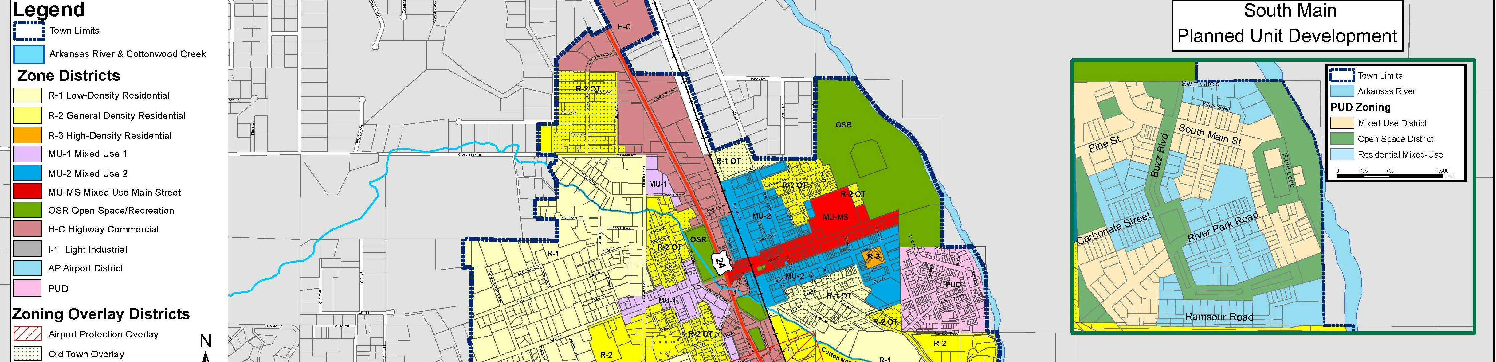
Our zoning map shows that we have several zone 'districts' - each with its own set of regulations on both physical development (setbacks, lot width, lot area, maximum height, etc), as well as allowed uses (residential, business, mixed, etc). These regulations are in place to help create consistency in places' look and feel. For example, the R-1 district is meant to be single-family homes on individual lots, so apartment buildings are not allowed. Similarly, in order to ensure each neighbor has consistent expectations, setbacks help keep buildings from be built right on property lines.
What zone district do I live in?
Knowing what zone district you live in can be helpful for knowing what you're allowed to do and what you're not allowed to do on your property!
You can find our zone map here - take a look and if you have questions contact us!
Is my property in the floodplain or floodway?
This is a really important question - in 2017 FEMA updated the flood maps. While in many cases it is still possible to build or remodel in the floodplain, it is definitely more of a process and we highly recommend hiring a surveyor and engineer who have experience in this arena!
If the floodplain and/or floodplain touches my property, but I want to build away from it, do I need a special process?
The answer is... it depends! Since the survey data FEMA used in the flood modeling is not exact - it is based upon 2’ contours, and the associated elevations are assumed to be +/- 1’. Even if the location of the building is not within a mapped floodplain it needs to be “reasonably safe from flooding”. If a property is impacted by a floodplain the best first step for an owner is to hire a qualified and licensed surveyor to get a elevation certificate for the proposed building location.
Having a survey which clearly shows that the building stays out of the floodplain and that the building's lowest finished floor at least 1’ above the Base Flood Elevation (BFE) will ensure the floodplain permit will be a slam dunk. All the other case within floodplain and especially within floodway can be done but become increasing more difficult and need more detail in the survey and increased nuance in the engineering.
Learn more at FEMA's website: https://msc.fema.gov/portal/home
Can't you make an exception for my floodplain or floodway project?
Unfortunately the answer is no. If Town is found to not follow FEMA's regulations for development in or near the floodplain or floodway, it could jeopardize any and all emergency assistance in the future. In other words, if we ignore these regulations and a big fire or flood hits, FEMA could deny assistance to all town residents and the Town itself.
In addition, if we don't follow the regulations, it could void your homeowners' insurance policy should you ever need to make a claim!